Unveiling Keela’s Merino Zip Top: Field Trial & Expert Review
August 16, 2023St Oswald’s Way – Stage 5 – Rothbury to Kirkwhelpington.
September 12, 2023
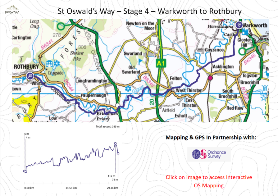
St Oswald’s Way – Stage 4 – Warkworth to Rothbury.This is the third stage of the 97-mile St Oswald’s Way. We now head inland from the coast to the Simonside Hills, a varied 13.5-mile days walk. |
|
Normal |
|
13.5 miles |
|
OS Explorer 332-440 |
|
5:40 |
|
| Start Point | |